Close
Close
Advanced Search

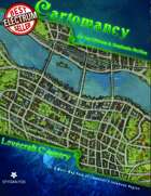
Cartomancy 23: Lovecraft Country Map Pack for Call of CthulhuClick to magnify
Quick Preview
/gs_flipbook/flip.php?xml=/demo_xml/289296.xml&w=500&h=323
Full‑size Preview
https://watermark.drivethrurpg.com/pdf_previews/289296-sample.pdf

Cartomancy 23: Lovecraft Country Map Pack for Call of Cthulhu

ADD TO WISHLIST >

West of Arkham the hills rise wild, and there are valleys with deep woods that no axe has ever cut. There are dark narrow glens where the trees slope fantastically, and where thin brooklets trickle without ever having caught the glint of sunlight. On the gentler slopes there are farms, ancient and rocky, with squat, moss-coated cottages brooding eternally over old New England secrets in the lee of great ledges; but these are all vacant now, the wide chimneys crumbling and the shingled sides bulging perilously beneath low gambrel roofs.

Howard Phillips Lovecraft "HPL," The Colour Out of Space

Lovecraft County

The Massachusetts Northshore towns, nestled along the banks of the Miskatonic River, seem steeped in eldrith happenings and terrifying events. This Cartomancy Map Pack reveals 5 of them, for use in a 1920s game, as well as a map of the region. Includes 10 high resolution maps, suitable for large format printing or on-screen viewing.

These are for personal use only - Not Stock Art.

Arkham

Lovecraft County Map

This map presents the locations and roads of the eastern part of it historic Lovecraft County, from Kingsport and Martin's Beach on the Atlantic coast, to storied Arkham itself just a few miles upriver, and then as far north as Newburyport on the Merrimac River, with Innmouth and Falcon Point located just east of Ipswich. Main roads, secondary roads, railroads, swamps, hills, lighthouses, and more are all present on the map. An inset map shows the entire Commonwealth, but only a few select towns, as found in the Miskatonic Valley. While the inset map doesn't show any roads, the Aylesbury Pike follows the Miskatonic (more-or-less), from Arkham all the way to Aylesbury.

Arkham Maps

  • City Map
  • Trolley Route Map 
  • Poverty Map (similar to Charles Booth's Victorian-era Poverty Maps of London)
What lay behind our joint love of shadows and marvels was, no doubt, the ancient, mouldering, and subtly fearsome town in which we live – witch-cursed, legend-haunted Arkham, whose huddled, sagging gambrel roofs and crumbling Georgian balustrades brood out the centuries beside the darkly muttering Miskatonic.

HPL, The Thing on the Doorstep

Dunwich Maps

  • Township Map
  • Regional Map

Across a covered bridge one sees a small village huddled between the stream and the vertical slope of Round Mountain, and wonders at the cluster of rotting gambrel roofs bespeaking an earlier architectural period than that of the neighbouring region. It is not reassuring to see, on a closer glance, that most of the houses are deserted and falling to ruin, and that the broken-steepled church now harbours the one slovenly mercantile establishment of the hamlet. One dreads to trust the tenebrous tunnel of the bridge, yet there is no way to avoid it. Once across, it is hard to prevent the impression of a faint, malign odour about the village street, as of the massed mould and decay of centuries. It is always a relief to get clear of the place, and to follow the narrow road around the base of the hills and across the level country beyond till it rejoins the Aylesbury pike. Afterward one sometimes learns that one has been through Dunwich.

HPL, The Dunwich Horror

Foxfield Map

Located on the Fox River, a tributary of the Miskatonic, 4 miles off the Aylesbury Pike and an hour's drive from Arkham, lies a farming community split in two by more than just the Fox. The town, proper, is in good repair, if in need of fresh paint, and the church steeple rises high above the other buildings, but the industry that once prospered has long since left. The southern farms have gone back to growing food crops, but the farms to the north, where the rocky hills meet dark New England woods, struggle to make a living in the bucolic town of Foxfield.

Innsmouth Map

It was a town of wide extent and dense construction, yet one with a portentous dearth of visible life. From the tangle of chimney-pots scarcely a wisp of smoke came, and the three tall steeples loomed stark and unpainted against the seaward horizon. One of them was crumbling down at the top, and in that and another there were only black gaping holes where clock-dials should have been. The vast huddle of sagging gambrel roofs and peaked gables conveyed with offensive clearness the idea of wormy decay, and as we approached along the now descending road I could see that many roofs had wholly caved in. There were some large square Georgian houses, too, with hipped roofs, cupolas, and railed “widow’s walks”. These were mostly well back from the water, and one or two seemed to be in moderately sound condition.

HPL, The Shadow Over Innsmouth

Kingsport Maps

  • Town Map
  • Neighborhood/District Map
Then beyond the hill’s crest I saw Kingsport outspread frostily in the gloaming; snowy Kingsport with its ancient vanes and steeples, ridgepoles and chimney-pots, wharves and small bridges, willow-trees and graveyards; endless labyrinths of steep, narrow, crooked streets, and dizzy church-crowned central peak that time durst not touch; ceaseless mazes of colonial houses piled and scattered at all angles and levels like a child’s disordered blocks; antiquity hovering on grey wings over winter-whitened gables and gambrel roofs; fanlights and small-paned windows one by one gleaming out in the cold dusk to join Orion and the archaic stars. And against the rotting wharves the sea pounded; the secretive, immemorial sea out of which the people had come in the elder time.

HPL, The Festival
pixel_trans.gif
pixel_trans.gif
 
 Customers Who Bought this Title also Purchased
pixel_trans.gif
pixel_trans.gif
Reviews (2)
Discussions (3)
Customer avatar
raphael P February 26, 2022 5:34 pm UTC
PURCHASER
There is a resolution issue with the trolley map...
Reply
Customer avatar
Chitin P March 06, 2022 5:51 pm UTC
PUBLISHER
We've uploaded a new PDF with an updated Trolley Map. Should be all set.
Customer avatar
Ronaldo M April 10, 2020 12:03 pm UTC
PURCHASER
Hello. This set of maps comes only in a pdf. I thought it would come with jpgs from each map so I can use it in a VTT. That way it is not really useful. You could release the jpgs in a resolution sufficient to use in roll20.
Reply
Customer avatar
Ronaldo M April 10, 2020 4:46 pm UTC
PURCHASER
They explained the motives to me, and I´m satisfied. The support is very good.
Reply
Customer avatar
Piotr M June 06, 2021 1:55 pm UTC
Thanks for the comment, I would have bought the pack, too, but luckily you saved my $6.99 ;)
Reply
Customer avatar
Chitin P March 06, 2022 5:51 pm UTC
PUBLISHER
We've added individual hi-res versions of the maps that are useable in VTTs now.
Customer avatar
Rafał P September 30, 2019 6:51 pm UTC
PURCHASER
Sorry Guys, but the Arkham Trolley Route Map is in VERY [and I mean very] bad resolution.
Reply
Customer avatar
Chitin P March 06, 2022 5:52 pm UTC
PUBLISHER
Sorry about that. It's been fixed now.
Reply
Customer avatar
Rafał P March 06, 2022 7:15 pm UTC
PURCHASER
THNXXX
Browse Categories
$ to $
 Publisher
 Follow Your Favorites!
NotificationsSign in to get custom notifications of new products!


Product Information
Gold seller
Pages
10
Publisher Stock #
SFX-2023
File Size:
384.77 MB
Format
Original electronic Click for more information
Scanned image
These products were created by scanning an original printed edition. Most older books are in scanned image format because original digital layout files never existed or were no longer available from the publisher.

For PDF download editions, each page has been run through Optical Character Recognition (OCR) software to attempt to decipher the printed text. The result of this OCR process is placed invisibly behind the picture of each scanned page, to allow for text searching. However, any text in a given book set on a graphical background or in handwritten fonts would most likely not be picked up by the OCR software, and is therefore not searchable. Also, a few larger books may be resampled to fit into the system, and may not have this searchable text background.

For printed books, we have performed high-resolution scans of an original hardcopy of the book. We essentially digitally re-master the book. Unfortunately, the resulting quality of these books is not as high. It's the problem of making a copy of a copy. The text is fine for reading, but illustration work starts to run dark, pixellating and/or losing shades of grey. Moiré patterns may develop in photos. We mark clearly which print titles come from scanned image books so that you can make an informed purchase decision about the quality of what you will receive.
pixel_trans.gif
Original electronic format
These ebooks were created from the original electronic layout files, and therefore are fully text searchable. Also, their file size tends to be smaller than scanned image books. Most newer books are in the original electronic format. Both download and print editions of such books should be high quality.
File Information
Watermarked PDF Click for more information
Watermarked PDF

These PDF files are digitally watermarked to signify that you are the owner. A small message is added to the bottom of each page of the PDF containing your name and the order number of your purchase.

Warning: If any files bearing your information are found being distributed illegally, then your account will be suspended and legal action may be taken against you.

Here is a sample of a page from a watermarked title:

File Last Updated:
March 06, 2022
This title was added to our catalog on September 20, 2019.